Property Record
685 State Ave, Emmaus, PA 18049


NEARBY LISTINGS FOR SALE OR LEASE
Property Detail
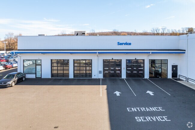
685 State Ave
Allentown-Bethlehem-Easton, PA-NJ
Wickes Subdivision Vinart Dealerships
549561496043-1
LOTS: 028, B
Autorepair
Lehigh
X
Pennsylvania
42077C0261F
28 b
2025
2.08 AC
2025
Lehigh Valley
006500
Philadelphia
36,823 SF
DEMOGRAPHICS near 685 State Ave
1 Mile
3 Mile
5 Mile
2024 Total Population
10,184
59,960
204,307
2029 Population
10,335
60,432
205,879
Pop Growth 2024-2029
+ 1.48%
+ 0.79%
+ 0.77%
Average Age
40
40
39
2024 Total Households
4,222
23,687
77,350
HH Growth 2024-2029
+ 1.40%
+ 0.73%
+ 0.82%
Median Household Inc
$66,338
$68,604
$62,590
Avg Household Size
2.40
2.40
2.50
2024 Avg HH Vehicles
2.00
2.00
2.00
Median Home Value
$224,339
$232,073
$243,312
Median Year Built
1964
1964
1963
Nearby Places
Map Layers
Map Styles
 Street
 Aerial
- Restaurants
- Banks
- Shops
- Fitness
- Groceries
PUBLIC TRANSPORTATION
AIRPORT
Lehigh Valley International
DRIVE
WALK
Distance
Lehigh Valley International
19 min
8.7 mi
Freight Ports
Port of Philadelphia
DRIVE
WALK
Distance
Port of Philadelphia
85 min
51.8 mi
Nearby Properties
Address
Land Use
TOTAL SIZE
Lot Size
Zoning
Address
Land Use
TOTAL SIZE
Lot Size
Zoning
504,141 SF
44.47 AC
R2
Address
Land Use
TOTAL SIZE
Lot Size
Zoning
413,834 SF
40 AC
R-L
Address
Land Use
TOTAL SIZE
Lot Size
Zoning
135,668 SF
5 AC
R3
Address
Land Use
TOTAL SIZE
Lot Size
Zoning
112,456 SF
5 AC
R3
Address
Land Use
TOTAL SIZE
Lot Size
Zoning
1,250 SF
80.20 AC
CR
Address
Land Use
TOTAL SIZE
Lot Size
Zoning
48,816 SF
197.98 AC
I-2
Address
Land Use
TOTAL SIZE
Lot Size
Zoning
19,850 SF
15.01 AC
R3
Address
Land Use
TOTAL SIZE
Lot Size
Zoning
128,106 SF
10.14 AC
C1
Address
Land Use
TOTAL SIZE
Lot Size
Zoning
7,200 SF
22.31 AC
I-3
Address
Land Use
TOTAL SIZE
Lot Size
Zoning
44,302 SF
17.25 AC
I-L
Address
Land Use
TOTAL SIZE
Lot Size
Zoning
88,600 SF
3.97 AC
R-H
Address
Land Use
TOTAL SIZE
Lot Size
Zoning
1,154,183 SF
83.21 AC
I-3
Address
Land Use
TOTAL SIZE
Lot Size
Zoning
84,564 SF
20.53 AC
R1
Address
Land Use
TOTAL SIZE
Lot Size
Zoning
140,780 SF
21.91 AC
I-G
Address
Land Use
TOTAL SIZE
Lot Size
Zoning
63,204 SF
8.97 AC
R3
Address
Land Use
TOTAL SIZE
Lot Size
Zoning
12,688 SF
13.47 AC
R4
Address
Land Use
TOTAL SIZE
Lot Size
Zoning
270,783 SF
15.12 AC
I-3
Address
Land Use
TOTAL SIZE
Lot Size
Zoning
39,485 SF
8.16 AC
C3
Address
Land Use
TOTAL SIZE
Lot Size
Zoning
46,171 SF
10.46 AC
B-3
Address
Land Use
TOTAL SIZE
Lot Size
Zoning
14,368 SF
12.64 AC
R-MH
Address
Land Use
TOTAL SIZE
Lot Size
Zoning
2,069 SF
16.39 AC
R-MP
Address
Land Use
TOTAL SIZE
Lot Size
Zoning
205,966 SF
3.26 AC
R-H
Address
Land Use
TOTAL SIZE
Lot Size
Zoning
14,330 SF
11.32 AC
R-M
Address
Land Use
TOTAL SIZE
Lot Size
Zoning
2,866 SF
12.21 AC
R-M
Address
Land Use
TOTAL SIZE
Lot Size
Zoning
161,790 SF
57.13 AC
I-2
Address
Land Use
TOTAL SIZE
Lot Size
Zoning
109,667 SF
8.45 AC
HC
Address
Land Use
TOTAL SIZE
Lot Size
Zoning
13,160 SF
6.90 AC
R-L
Address
Land Use
TOTAL SIZE
Lot Size
Zoning
7,184 SF
6.30 AC
R-MH
Address
Land Use
TOTAL SIZE
Lot Size
Zoning
19,124 SF
14.03 AC
R-P
Address
Land Use
TOTAL SIZE
Lot Size
Zoning
13,920 SF
7.36 AC
R-MH
The World's #1 Commercial Real Estate Marketplace
Connect with us
© 2025 CoStar Group
The information above has been obtained from sources believed reliable. While we do not doubt its accuracy we have not verified it and make no guarantee, warranty or representation about it. It is your responsibility to independently confirm its accuracy and completeness. Any projections, opinions, assumptions, or estimates used are for example only and do not represent the current or future performance of the property. The value of this transaction to you depends on tax and other factors which should be evaluated by your tax, financial, and legal advisors. You and your advisors should conduct a careful, independent investigation of the property to determine to your satisfaction the suitability of the property for your needs.